Flooding
 Floods can happen frequently and have the potential to cause a lot of damage.
They are usually the result of heavy rain or thunderstorms and can damage properties, pollute water and land, and cause injuries or even loss of life.
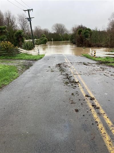
Floods become dangerous if the water is very deep, travelling very fast, has risen very quickly, or if it contains debris like tree branches and sheets of iron.
Flooding in Selwyn
The Selwyn District is bounded by two large, braided rivers: the Waimakariri to the north and the Rakaia to the south. A network of foothill fed rivers, lowland streams, ephemeral waterways, wetlands, springs and other waterways flow into Te Waihora, Lake Ellesmere. The Waikirikiri/Selwyn River flows through the centre of the district.
Selwyn District is prone to flooding, given the extensive low-lying plains and many waterways.
How did the Council identify areas at risk of flooding?
When looking at flood hazards outside coastal areas, Selwyn District Council have a flood model which is used to identify areas at risk of flooding. The model was built by Tonkin & Taylor in 2024 – 2025, and peer reviewed by Pattle Delamore Partners. The model covers the Selwyn District plains area, with more detail within the townships of Darfield, Lincoln, Springston, Rolleston, Leeston, Doyleston, Southbridge, Tai Tapu, Prebbleton, Kirwee and West Melton.
Flood model results are hosted by Environment Canterbury Regional Council (ECan): Flood Model Results
The detailed model build report is available here.
What can I see on the map?
The map shows the extent and depth of potential flooding during a range of storm events:
- 10-year ARI (10% AEP)
- 100-year ARI (1% AEP)
- 200-year ARI (0.5% AEP)
- 500-year ARI (0.2% AEP)
All storm events include rainfall intensities that account for climate change effects (RCP 8.5 to year 2081 – 2100).
You can also select to see the:
- Modelled water level (m above vertical datum)
- Modelled water velocity (m/s)
- Modelled extent of high hazard areas, where the model indicates that either:
- the water depth is greater than 1 m, or
- the water depth (in metres) x the water velocity (in metres per second) is equal to or greater than 1.
- Critical duration: the rainfall event duration (either 1, 6, 12, 24, 48 or 72-hour) which results in the maximum water level at a given location
Explanation of terms
The term ARI (Average Recurrence Interval) and AEP (Annual Exceedance Probability) are used to describe the probability of a flow of a certain size occurring in any river or stream.
ARI is the average time period that is predicted will pass between floods of a certain size. For example, a 200-year ARI flood will occur on average once every 200 years. Alternatively, AEP is the probability of a certain size of flood flow occurring in a single year. A 0.5% AEP flood flow) means that a one-in-200-year flood has 0.5% chance of happening in any one year. We also call such a flood a one-in-200-year flood.
Therefore, the 200-year ARI flow and 0.5% AEP flow are different terms to describe a flow of the same size.
During a flood
- Self-evacuate if you feel unsafe, don’t wait for an official warning.
- If your life is in imminent danger call 111.
- Do not try to walk or drive through flood water.
- If time permits, move valuable and dangerous items as high above the floor as possible. This includes electrical equipment and chemicals.
- Follow the instructions of civil defence and emergency services.
- Listen to the radio. RNZ (Radio New Zealand) National is the country’s statutory civil defence lifeline radio broadcaster, providing vital information and updates as they come to hand. The frequencies in Canterbury are AM 675 and FM 101.7.
Sandbagging
It is the responsibility of property owners to take appropriate action to protect their property from flooding.
During storm events and flooding, Council, Selwyn Emergency Management, Council contractors, and emergency services will be focused on preserving life and protecting key infrastructure such as roads, water, and sewage. It is unlikely they will be able to assist with sandbagging individual properties.
Sandbags can help protect your home. They can be useful for addressing localised flooding, e.g. to stop water flowing under a garage door or diverting it downhill, but they don’t protect against water coming from under a house and through floorboards.
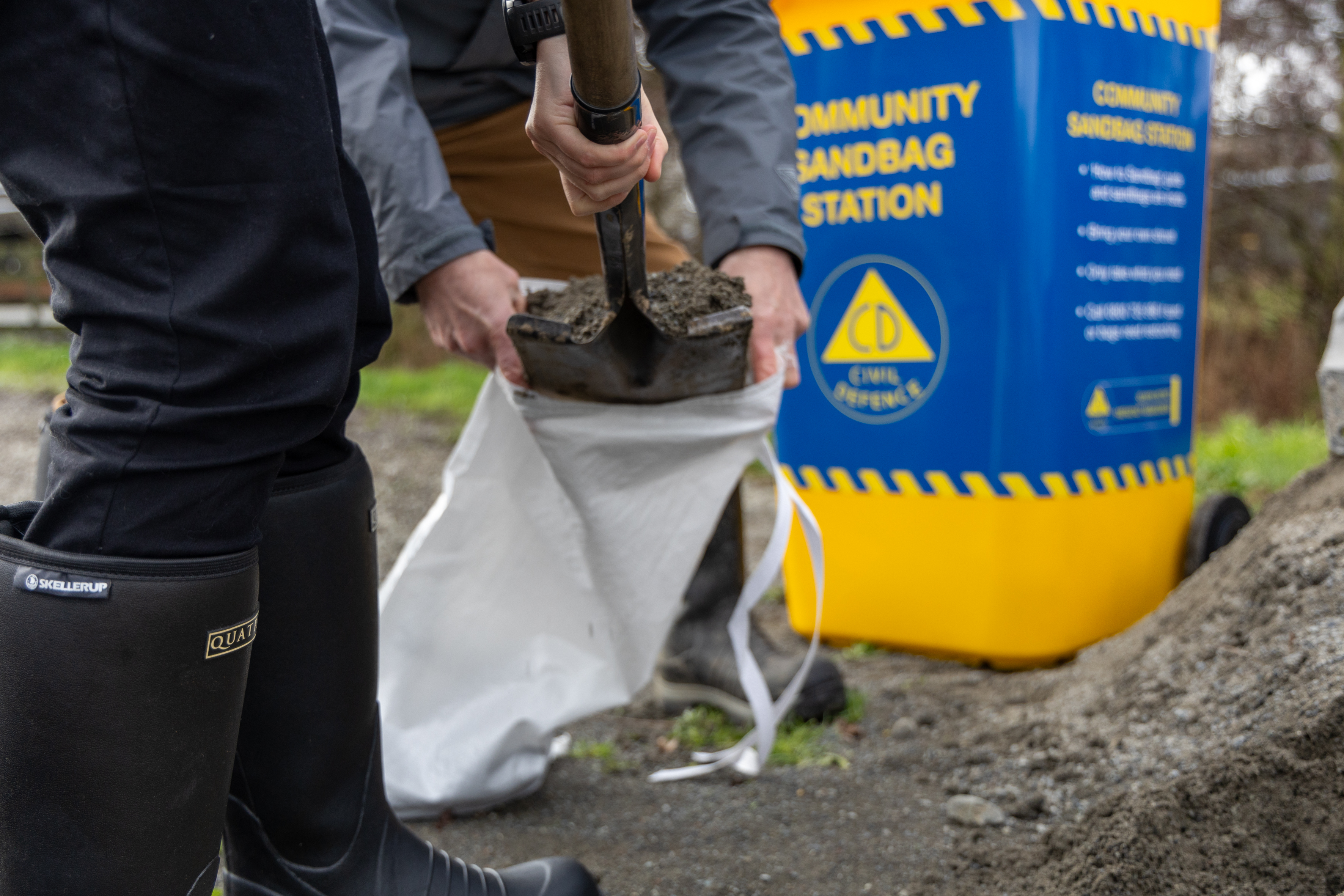 Community sandbag stations
If possible and safe to do so, Selwyn Emergency Management will establish a limited number of community sandbag stations. These stations will include sand, sandbags, and instructions [PDF, 601 KB]on how to sandbag your home.
In using the stations, residents need to be prepared to fill and transport the sandbags and are responsible for disposing of the bags after use.
After a flood
- Return home only when emergency services or Civil Defence say it's safe
- Be cautious as floors and surfaces may be slippery or uneven, and debris may hide hazards like broken glass or nails
- Avoid floodwater as it may be contaminated
- Don’t turn electricity back on until it’s been checked
- Avoid using tap water unless Council or Selwyn Water confirms it’s safe. Follow boil water notices if given
- Help others where you can, especially those needing extra assistance
- Contact Council if drains, roads, or public areas are damaged
For damaged property
- Avoid do-it-yourself actions that might risk safety or cause more damage
- Contact your insurance or landlord promptly
- Take photos of damage to support insurance claims
- Clean up safely. Wet items may contain mould or harmful contaminants, so wear protective gear like gloves, boots, and a mask
For more advice about being prepared for an emergency event, visit getready.govt.nz