Are you in a Snowfall Area?
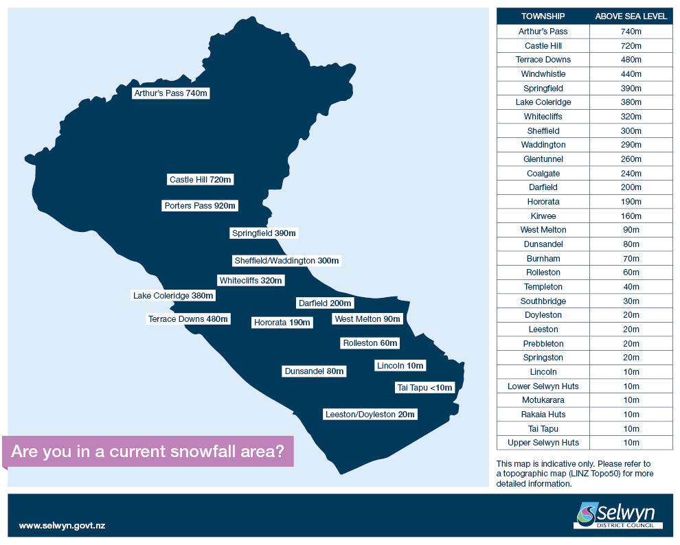
This map is indicative only. Please refer to a topographic map (LINZ Topo50) for more detailed information.
Elevations Above Sea Level
| By Elevation | Alphabetical |
|---|---|
|
Arthur's Pass 740m Castle Hill 720m Terrace Downs 480m Windwhistle 440m Springfield 390m Lake Coleridge 380m Whitecliffs 320m Sheffield 300m Waddington 290m Glentunnel 260m Coalgate 240m Darfield 200m Hororata 190m Kirwee 160m West Melton 90m Dunsandel 80m Burnham 70m Rolleston 60m Templeton 40m Southbridge 30m Doyleston 20m Leeston 20m Prebbleton 20m Springston 20m Lincoln 10m Lower Selwyn Huts 10m Motukarara 10m Rakaia Huts 10m Tai Tapu 10m Upper Selwyn Huts 10m |
Arthur's Pass 740m Burnham 70m Castle Hill 720m Coalgate 240m Darfield 200m Doyleston 20m Dunsandel 80m Glentunnel 260m Hororata 190m Kirwee 160m Lake Coleridge 380m Leeston 20m Lincoln 10m Lower Selwyn Huts 10m Motukarara 10m Prebbleton 20m Rakaia Huts 10m Rolleston 60m Sheffield 300m Southbridge 30m Springfield 390m Springston 20m Tai Tapu 10m Templeton 40m Terrace Downs 480m Upper Selwyn Huts 10m Waddington 290m West Melton 90m Whitecliffs 320m Windwhistle 440m |